- "I-15" redirects here. For other roads numbered I-15, see I-15 (disambiguation).
Interstate 15 (I-15) is a north–south Interstate Highway in southern California and Nevada, northwestern Arizona, central Utah, eastern Idaho, and western Montana in American Truck Simulator. It runs from Interstate 8 in San Diego to US 2 in Shelby.
Course[]
Interstate 15 in ATS begins at its junction with Interstate 8 just east of San Diego, and immediately climbs over the Peninsular Ranges to Interstate 10, the highway in this segment being six lanes wide. North of I-10, the highway continues climbing, this time over the Transverse Ranges, reaching its climax at Cajon Summit, which has an elevation of 4260 ft. This grade is rather steep, and features a slow vehicle lane for northbound traffic. North of the summit, the highway reaches CA 58 and Barstow, which offers services off the highway to the south of town. After leaving Barstow, the highway meets with Interstate 40 at its western terminus, passes the town of Baker (notable for having the world's tallest thermometer, which is visible from the road), and sets off through the desolate Mojave Desert in the south of the Great Basin.
Right after crossing into Nevada, the highway passes through the border town of Primm, and soon after moves through Las Vegas, where it intersects with US 95 and 93, the latter having a brief concurrency. Leaving Las Vegas, I-15 soon crosses into Arizona, where it runs a short but scenic stretch through the Virgin River Gorge. Leaving the gorge, the highway enters the Colorado Plateau and the state of Utah.
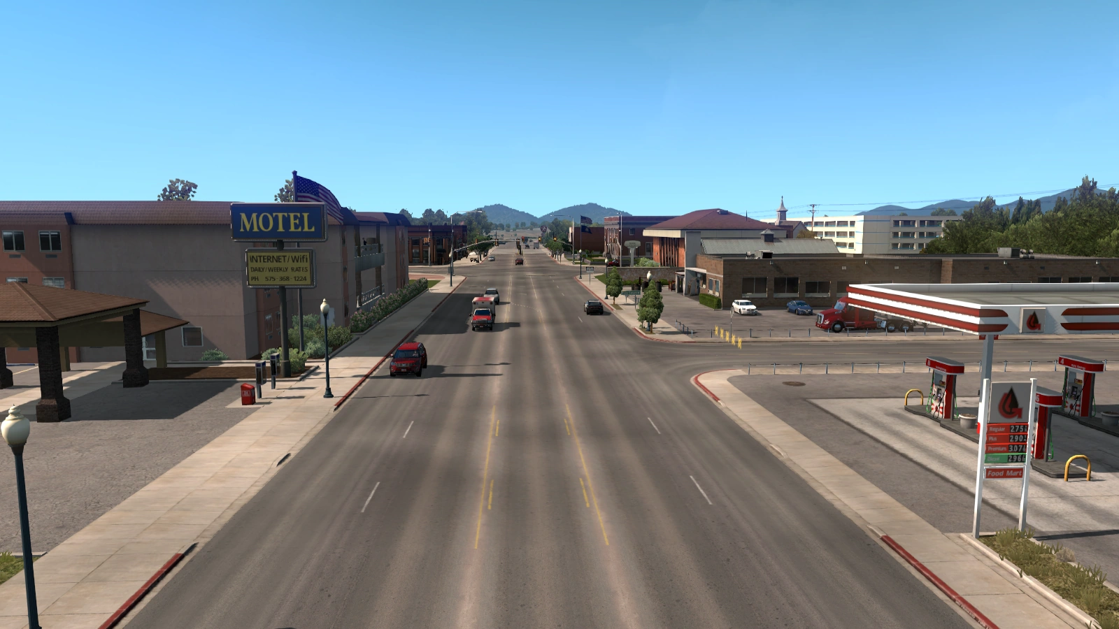
After crossing the state line, travelers are greeted by north and southbound Weigh Stations (which feature Rest Stops) before passing through the city of St. George. North of town, UT-9 is reached, and soon after the highway exits the Colorado Plateau, re-entering the Great Basin. It is here that the highway passes through Cedar City, and proceeds along the edge of the Colorado Plateau, which stands prominently to the east of the highway in the form of high, tree-covered plateaus. After traversing a summit, I-15 intersects with Interstate 70 at its western terminus at Cove Fort, the fort itself being accessible from the highway. After another summit, the highway encounters US 50 and the town of Scipio, and proceeds through the desert alongside the Wasatch Mountains. It soon passes Provo, and shortly afterward reaches Salt Lake City and Interstate 80, followed quickly by Ogden and Interstate 84, which begins a short concurrency. North of Ogden are north and southbound weigh stations, and further north is Brigham City, which offers travel services and access to Logan via US 89 and 91. At Tremonton, where there are more services, I-84 breaks away to the northwest while I-15 continues its northern trend into Idaho.
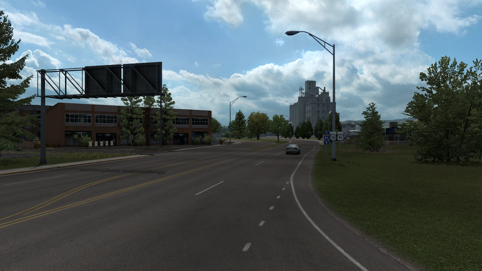
Soon after entering Idaho, the highway crosses the Bannock Range via Malad Summit (5574 ft) and descends into McCammon and Inkom, where notable cliffs rise over the road. After north and southbound weigh stations, Pocatello is reached, and with it, Interstate 86. The highway proceeds through the Snake River Plain and across a rather large lava field, which features north and southbound Rest Stops. Shortly afterwards the city of Idaho Falls is reached, where the highway crosses paths with US 20 and US 26. North of Idaho Falls is the Sage Junction Port of Entry, a weigh station with a rest area, and from there the highway continues to Montana.
I-15 enters Montana via Monida Pass, where the highway crosses the Great Continental Divide between the Centennial Mountains to the east and the Beaverhead Mountains to the west; at 6870 feet (2094 m), this is the highest point of I-15. Descending from the moutains, the highway passes the town of Lima, which features a rest area, and runs through the valley of the Red Rock, between the Tendoys (a subrange of the Beaverheads) to the west and the Blacktails to the east. The highway then skirts the eastern shore of the Clark Canyon Reservoir, and proceeds along the Beaverhead River to the towns of Barretts and Dillon; the former has a truck stop and a Coastline Mining depot. North of Dillon, the highway crosses the Great Divide a second time via Deer Lodge Pass (5879 ft/1792 m), between the Anaconda Range to the west and the Highland Mountains to the east. The highway then passes the Port of Montana, an outlying industrial park of Butte, and shortly after runs along a short concurrency with I-90 to Butte proper, which is accessible by the spur route I-115. I-15 separates from I-90 at the feet of the Boulder Mountains, and proceeds to climb along the east side of Butte up Elk Park Pass (6352 ft/1936 m), where the highway crosses the Great Divide a third time, making I-15 notable for crossing the Divide more times than any other Interstate Highway. After weaving through the Boulder Mountains, the highway passes through Montana's capital city of Helena, and proceeds through Helena Valley, where the iconic Sleeping Giant mountain formation is clearly visible. I-15 then runs along the Missouri River through the Adel Mountains, where the river has carved a rather scenic canyon; in this gorge are the towns Craig and Mid Canon, as well as north and southbound rest areas. Leaving the Missouri River Canyon, the highway passes the city of Great Falls, where it meets US 87 and MT 200. Past Great Falls, the 15 runs across vast, open plains in the shadow of the distant Sawtooth range to the west. There the highway passes the town of Conrad, which has a weigh station and services, and currently ends at the town of Shelby, where the highway intersects with US 2. From Shelby it's a short distance further to the Canadian border.
Cities[]
Exit list[]
California[]
| Location | mi | Exit | Destinations | Facilities | Notes |
|---|---|---|---|---|---|
| San Diego | 0 | 6 | South terminus in game | ||
| 100 | 109 A-B | ||||
| Barstow | 151 | 175 | Outlet Center Drive | ||
| 157 | 178 | Lenwood Road | |||
| 166 | 179 | ||||
| 175 | 181 | L Street / West Main Street | |||
| 185 | 183 | Barstow | |||
| 197 | 184 | ||||
| 256 | ---- | Rest area |
Nevada[]
| Location | mi | Exit | Destinations | Facilities | Notes |
|---|---|---|---|---|---|
| Primm | 312 | 1 | Primm | ||
| Las Vegas | 328–340 | 35 | Russell Road | ||
| 344–356 | 38 A–B | Flamingo Road | Northbound exit 38 | ||
| 357 | 42 A–B | Southbound exit 42; South end of US 93 concurrency; I-515 and US 95 exits 76 A–B | |||
| 373 | 46 | Cheyenne Avenue | |||
| 379 | 64 | North terminus in base game North end of US 93 concurrency |
Arizona[]
| Location | mi | Exit | Destinations | Facilities | Notes |
|---|---|---|---|---|---|
| No exits in Arizona | |||||
Utah[]
| Location | mi | Exit | Destinations | Facilities | Notes |
|---|---|---|---|---|---|
| 445 | ---- | Weigh station | |||
| St. George | 453 | 4 | Brigham Road | ||
| 456 | 8 | ||||
| Washington | 465 | 16 | |||
| Cedar City | 497 | 57 | |||
| 503 | 62 | ||||
| 536 | 132 | ||||
| 556 | 135 | Historic Cove Fort | |||
| 597 | 172 | ||||
| Scipio | 609 | 188 | |||
| Provo | 664 | 257 A | Main Street | Southbound only; inaccessible | |
| 668 | 257 B | ||||
| 687 | 272 | ||||
| Salt Lake City | 707 | 293 | |||
| 717 | 304 | South end of I-80 concurrency | |||
| 720 | 305 A–D | Northbound only; inaccessible | |||
| 728 | 308 | North end of I-80 concurrency | |||
| Ogden | 747 | 339 | Northbound exit and southbound entrance | ||
| 748 | 340 | South end of I-84 concurrency; southbound exit and northbound entrance | |||
| 750 | ---- | Weigh station | |||
| Brigham City | 755 | 362 | |||
| Tremonton | 775 | 379 | North end of I-84 concurrency; eastbound I-84 exit 41 | ||
| Riverside | 784 | 385 | North terminus in Utah DLC |
Idaho[]
| Location | mi | Exit | Destinations | Facilities | Notes |
|---|---|---|---|---|---|
| 804 | ---- | Rest area | Northbound only | ||
| 823 | ---- | Rest area | Southbound only | ||
| McCammon | 839 | 47 | South terminus in Idaho DLC South end of US 30 concurrency | ||
| 855 | ---- | Weigh station | |||
| Pocatello | 869 | 67 | North end of US 30 concurrency | ||
| 888 | 72 | I-86 exits 63 A–B | |||
| 905 | ---- | Rest area | |||
| Idaho Falls | 923 | 113 | Shelley | ||
| 925 | 118 | South end of US 20 concurrency | |||
| 927 | 119 | North terminus in game North end of US 20 concurrency |
Montana[]
TBA
Business Routes[]

Interstate 15 Business Loop shield
| This page uses Creative Commons Licensed content from Wikipedia (view authors). |
Cities[]
Interstate 15 has business routes in 3 cities:
Utah[]
There is one business route in Utah:
Cedar City[]

I-15 BL - Cedar City, UT
Interstate 15 Business is a business loop in Cedar City. It runs from exit 57 of I-15 north along SR-130 where it runs through the city east of I-15 until reaching exit 62.
Major intersections and facilities[]
Idaho[]
There are two business routes in Idaho:
Pocatello[]

I-15 Bus. - Pocatello, ID
Interstate 15 Business in Pocatello begins at its junction with Interstate 15, US 30, and US 91. The route follows the entirety of US 91 through the city and ends at US 30 (East Gould Street).
Major intersections and facilities[]
Idaho Falls[]

I-15 Bus. - Idaho Falls, ID
Interstate 15 Business in Idaho Falls begins at its junction with Interstate 15 and US 20. It follows West Broadway Street from I-15 to US 30 (Yellowstone Avenue), and then follows US 30 to the south until it terminates with West Sunnyside Road.
Major intersections and facilities[]
History[]
18 Wheels of Steel[]
- The highway first appeared in SCS Software's first trucking game, Hard Truck: 18 Wheels of Steel, where it connected the cities of Los Angeles and Las Vegas on the West Coast map, as well as Salt Lake City and Helena on the Rockies map.
- Interstate 15 can also be found in several later 18 Wheels of Steel games: In Across America it connects Interstate 40 with Salt Lake City and Great Falls and in Pedal to the Metal, Convoy, Haulin' and American Long Haul it also passes Las Vegas.
American Truck Simulator[]
- In the initial version of American Truck Simulator, Interstate 15 began at a trumpet interchange with Interstate 10 east of Los Angeles and headed north to Las Vegas. The small town currently on SR 58 west of Barstow near which a Coastline Mining quarry exists was situated on Interstate 15.
- In update 1.5, as part of the 1:35 to 1:20 map rescale, several new sections were added to the existing route to accommodate the new map scale, including the truck stop south of Barstow and its accompanying exits, as well as the rest area between Barstow and Primm. The small town west of Barstow was moved to its current location, and the junction with SR 58 was changed from an at-grade three-way junction to the current trumpet interchange.
- In update 1.29, the section of Interstate 15 from Los Angeles to San Diego was added, along with the current four-level stack interchange with Interstate 10 and the cloverstack interchange with Interstate 8.
- In the initial version of the Utah map expansion DLC, the section of Interstate 15 from US 93 in Las Vegas to Interstate 84 and US 91 in Brigham City was added.
- In update 1.38, the section of Interstate 15 from Interstate 84 and US 91 in Brigham City to SR-30 in Riverside was added. In Las Vegas, all interchanges were rebuilt. The diamond interchanges with Russell Road and Flamingo Road were changed to be reached via local lanes, and the former was rebuilt and the latter changed to a partial folded diamond interchange. The frontage road running parallel between the exits was removed. The trumpet interchange with US 95 was changed to a "Spaghetti Bowl" interchange with US 93 and US 95. The diamond interchange with US 93 on Cheyenne Avenue was separated into a single-point diamond interchange with the previous section of US 93 on Cheyenne Avenue and a diverging diamond interchange with US 93.
- In the initial version of the Idaho map expansion DLC, the section of Interstate 15 from SR-30 in Riverside to US 20 in Idaho Falls was added.
- In the initial version of the Montana map expansion DLC, the section of Interstate 15 from US 20 in Idaho Falls to US 2 in Shelby was added.
See also[]
| Cities | Bakersfield - Barstow - Carlsbad - El Centro - Eureka - Fresno - Hilt - Huron - Los Angeles (Santa Monica) - Modesto - Oakland (Richmond) - Oxnard - Redding - Sacramento - San Diego - San Francisco - San Jose - Santa Cruz - Santa Maria - Stockton - Truckee - Ukiah List of scenery towns in California |
|---|---|
| Highways | Interstate 5 - Interstate 8 - Interstate 10 - Interstate 15 - Interstate 40 - Interstate 80 - Interstate 580 US 6 - US 50 - US 95 - US 97 - US 101 - US 199 - US 395 SR 1 - SR 3 - SR 4 - SR 14 - SR 16 - SR 27 - SR 36 - SR 37 - SR 44 - SR 58 - SR 74 - SR 89 - SR 99 - SR 110 - SR 111 - SR 120 - SR 121 - SR 126 - SR 130 - SR 139 - SR 152 - SR 180 - SR 190 - SR 198 - SR 255 - SR 273 - SR 299 |
| See also | List of landmarks in California - List of Truck Stops in California |
| Cities | Carson City - Elko - Ely - Jackpot - Las Vegas - Pioche - Primm - Reno - Tonopah - Winnemucca |
|---|---|
| Highways | Interstate 11 - Interstate 15 - Interstate 80 - Interstate 515 - Interstate 580 US 6 - US 50 - US 93 - US 93 Alternate - US 95 - US 395 SR 140 - SR 225 - SR 292 - SR 305 - SR 319 - SR 374 - SR 375 - SR 376 |
| See also | List of landmarks in Nevada - List of Truck Stops in Nevada |
| Cities | Camp Verde - Clifton - Ehrenberg - Flagstaff - Grand Canyon Village - Holbrook - Kayenta - Kingman - Nogales - Page - Phoenix - San Simon - Show Low - Sierra Vista - Tucson - Yuma |
|---|---|
| Highways | Interstate 8 - Interstate 10 (Business routes) - Interstate 15 - Interstate 17 - Interstate 19 - Interstate 40 (Business routes) US 60 - US 64 - US 70 - US 89 - US 89A - US 93 - US 95 - US 160 - US 163 - US 180 - US 191 SR 51 - SR 61 - SR 64 - SR 66 - SR 77 - SR 85 - SR 89 - SR 90 - SR 92 - SR 98 - SR 260 - SR 303 - SR 389 |
| See also | List of landmarks in Arizona - List of Truck Stops in Arizona |
| Cities | Cedar City - Logan - Moab - Ogden (Roy) - Price - Provo (Mapleton, Orem, Spanish Fork) - Salina - Salt Lake City (Garfield, Herriman, Sandy, West Valley City) - St. George - Vernal |
|---|---|
| Highways | Interstate 15 - Interstate 70 - Interstate 80 - Interstate 84 US 6 - US 40 - US 50 - US 89 - US 89A - US 91 - US 163 - US 189 - US 191 - US 491 SR-9 - SR-10 - SR-26 - SR-30 - SR-34 - SR-52 - SR-55 - SR-56 - SR-59 - SR-130 - SR-151 - SR-161 - SR-165 - SR-172 - SR-201 - SR-202 - SR-265 |
| See also | List of landmarks in Utah - List of Truck Stops in Utah |
| Cities | Boise (Eagle, Meridian) - Coeur d'Alene (Fernan Lake Village) - Grangeville - Idaho Falls - Ketchum (Sun Valley) - Lewiston - Nampa - Pocatello (Inkom) - Salmon - Sandpoint (Ponderay) - Twin Falls |
|---|---|
| Highways | Interstate 15 - Interstate 84 - Interstate 86 - Interstate 90 US 2 - US 12 - US 20 - US 26 - US 30 - US 89 - US 91 - US 93 - US 95 SH-13 - SH-21 - SH-28 - SH-51 - SH-55 - SH-74 - SH-75 - SH-78 - SH-128 |
| See also | Idaho Highway Historical Marker Program - List of landmarks in Idaho - List of Truck Stops in Idaho |
| Cities | Billings (Lockwood) - Bozeman (Four Corners) - Butte (Rocker, Silver Bow) - Glasgow - Glendive - Great Falls - Havre (Havre North, West Havre) - Helena - Kalispell (Columbia Falls, Evergreen) - Laurel - Lewistown - Miles City - Missoula (Bonner-West Riverside, Wye) - Sidney - Thompson Falls |
|---|---|
| Highways | Interstate 15 - Interstate 90 - Interstate 94 - Interstate 115 US 2 - US 12 - US 20 - US 87 - US 89 - US 93 - US 191 - US 212 - US 287 - US 310 MT 3 - MT 16 - MT 19 - MT 23 - MT 24 - MT 47 - MT 56 - MT 59 - MT 84 - MT 85 - MT 135 - MT 200 - MT 200S S-205 - S-232 - S-243 - S-426 - S-474 |
| See also | List of landmarks in Montana - List of Truck Stops in Montana |